

3D mapping of different geobodies (channels and point bars) and evaluation of their properties from attribute cubes
Home Case studies 3D mapping of different geobodies (channels and point bars) and evaluation of their properties from attribute cubes
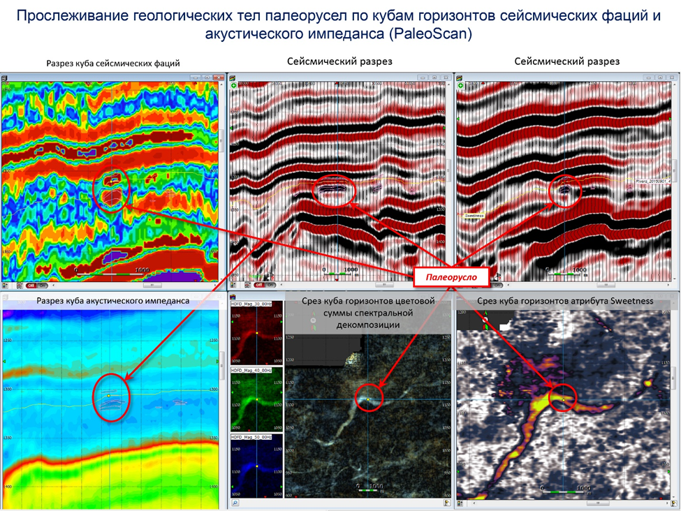
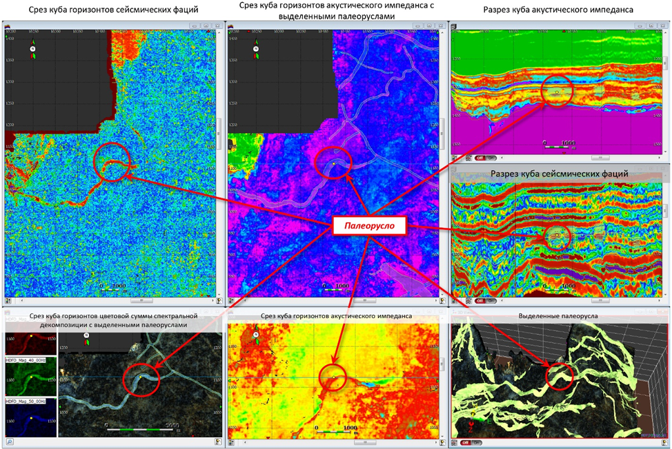
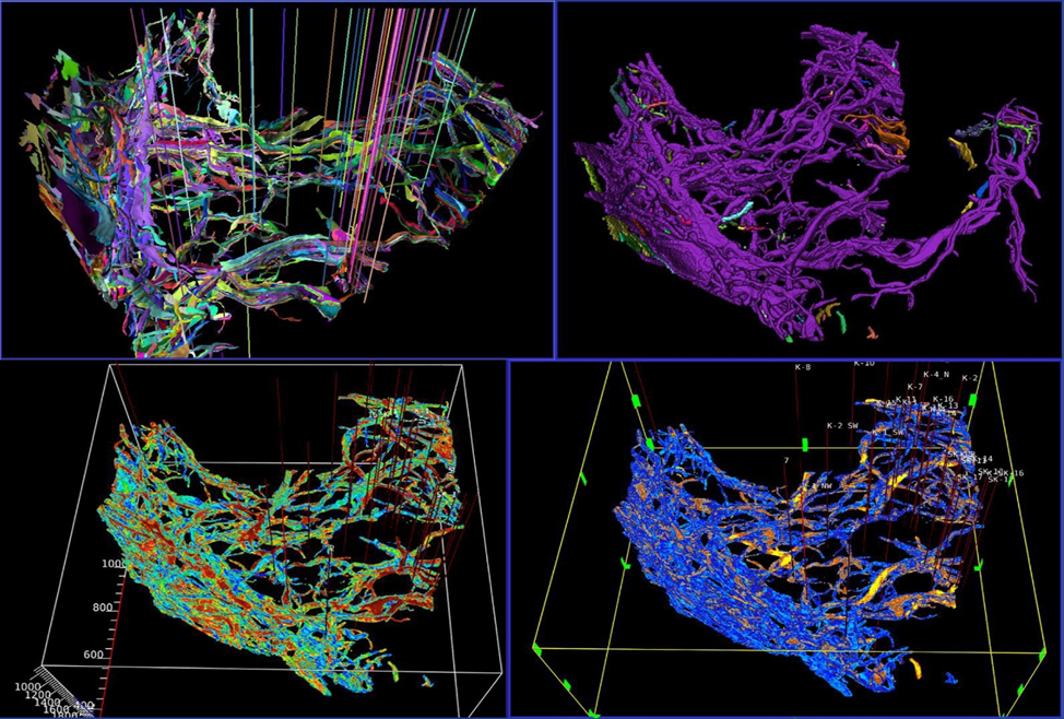
Use of horizon slices of seismic attribute cubes, seismic facies and the color sum of spectral decomposition cubes in PaleoScan allows to identify geological bodies of paleochannels, bars and point bar
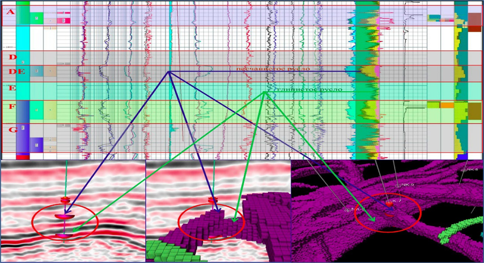
The geobodies of paleochannels correlate with log, core, and test data.
- 3D mapping of different geobodies (channels and point bars) and evaluation of their properties from attribute cubes
- Samples of digitization of logging data
- Evaluation of gas effect in in thin layered sandstones by ratio of impedances SIMP – AIMP
- Samples of correct reprocessing (Caspian)
- 3D Identification of geo-bodies using Halliburton GeoProbe
- Saturation forecast using cluster facial analysis
- Building a tectonic model of an object using new technologies (package GeoProbe
- Sedimentological analysis of core
- Sequence analysis (Sequence Stratigraphy)
- Function definition for oil saturation distribution